Stepwise Process Flow Details
- Step 1: Gather Spatial Layers of Containment Risk This initial step involves the collection of spatial layers that map various types of containment risks. These might include data on settlements near water bodies, waterlogged areas, flood-prone regions, hard-to-reach settlements, and locations of bulk wastewater generators.
- Step 2: Overlay Risk Layers on City Building Footprints Once the necessary spatial layers have been collected, these layers can be overlaid on a city-wide map of building footprints. This process visualizes the proximity of each building to the various containment risks identified in Step 1. GIS software like QGIS is typically used for this process.
- Step 3: Understand City-Wide Risk at Building Level After the risk layers have been overlaid on the building footprints, it is possible to start understanding the distribution of risks across the city. Different color codes can distinguish between safe zones and risk areas. Within the risk areas, further categorization by typology can highlight different levels or types of risks. This may include different colors or symbols for buildings that are close to water bodies, located in flood-prone areas, hard to reach, or generate large amounts of wastewater. This city-wide risk understanding will provide a comprehensive view of the containment challenges at the building level.
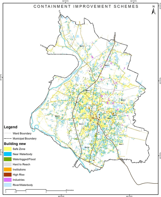
Figure 13 Illustrations of developing containment improvement scheme, Sherpur (Bangladesh)
Source – CWIS spatial analysis, Innpact Solutions and GWSC
No Comments