3.4 Assessment for Identifying Settlements Close to Waterbodies
3.4.1 Data Requirements
1. Waterbodies/ Rivers
2. Building footprint
3.4.2 Stepwise Process Flow Details
- Step 1: Overlay the Data Layers
Start by overlaying the water bodies, rivers, and building data layers on your map in the QGIS software. This involves using the 'Add Layer’ feature to import the
necessary layers into your map document. Ensuring that all these layers are on the same coordinate system is crucial for achieving accurate results.
- Step 2: Conduct Buffer Analysis
Next, perform a buffer analysis around the water bodies and rivers. Use the
'Buffer' tool within the ‘Vector Geometry’ section of the ‘Processing Toolbox’ menu. For water bodies, create a buffer of 30 feet and for rivers, create a buffer of 100 feet. This process essentially draws a boundary around the specified features (in this case, water bodies and rivers) at a set distance.
- Step 3: Identify Buildings within Buffer Regions
Having established your buffer zones, it's now time to identify the buildings within these areas. To do this, use the 'Select by Location' tool. This tool allows you to select features (in this case, buildings) based on their geographic
relationship to features within another layer (in this case, the buffer zones).
Ensure you select the buildings that fall within the buffer regions that you created in the previous step.
- Step 4: Categorize Buildings
Finally, classify all buildings that have been identified within the buffer regions as 'Water Proximity Buildings'. This can be done by creating a new field in the
attribute table of the building layer and assigning these buildings with a specific tag or code.
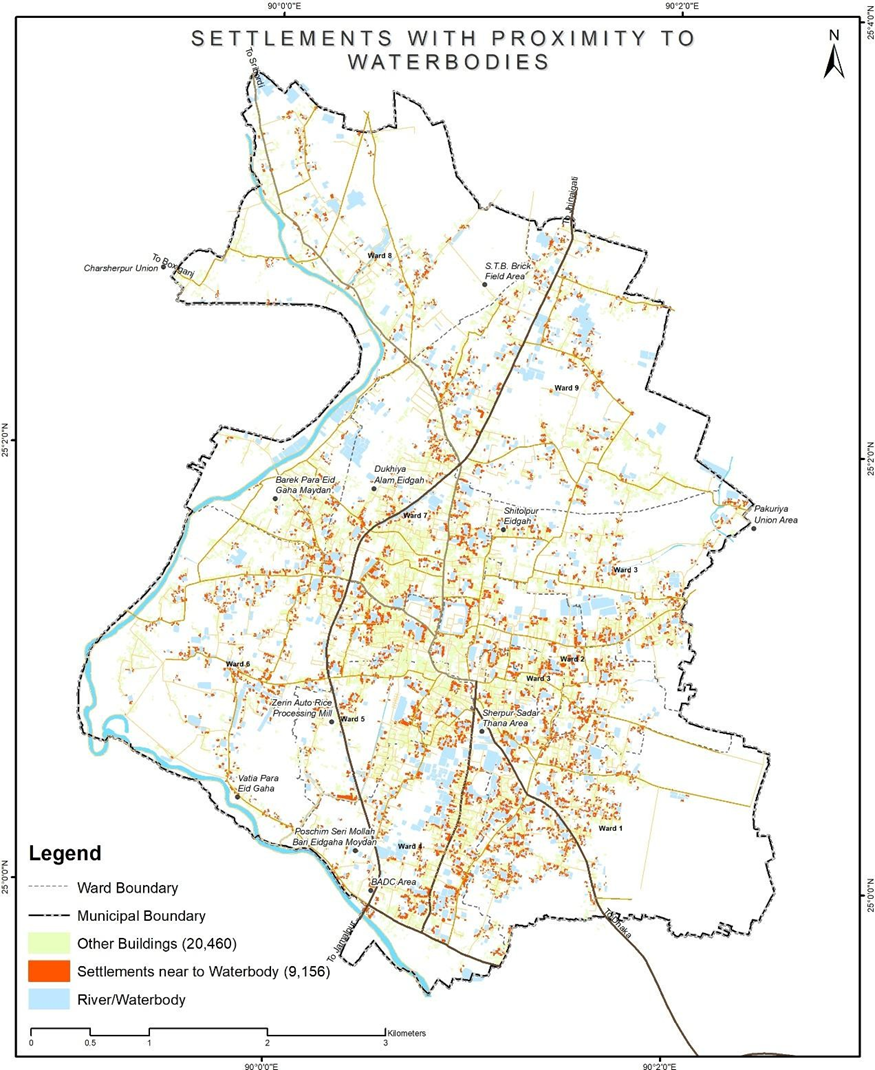
Figure 10 Illustrations for identifying settlements close to water bodies, Sherpur Source – CWIS spatial analysis , Innpact Solutions and GWSC
3.4.3 Output Application
Areas in proximity to water tend to have a heightened risk of untreated wastewater encroaching into nearby water bodies, which can have significant public health and environmental ramifications. Identifying such settlements can guide the selection of safe containment provisions in both existing and upcoming units. These units can also be integrated with building by-laws and ensure safe containment provisions in all future constructions.
No Comments