2.2 Road Network using Open Street Maps (OSM) Database
2.2.1 Stepwise Process Flow Details
- Step 1: Load the Study Area Boundary in QGIS
o Start your QGIS software and load the boundary file of your study area. You can do this by clicking on "Layer" in the top menu, then selecting "Add Layer" > "Add Vector Layer" and navigating to the file on your computer.
- Step 2: Install the OSM Downloader Plugin in QGIS
o To download the data from OpenStreetMap, you will need a specific plugin. From the top menu, select "Plugins" > "Manage and Install Plugins". Search for "OSM Downloader" and install it.
- Step 3: Select the Area of Interest Using the OSM Downloader Plugin
o Use the OSM Downloader plugin to select your area of interest. You can do this by selecting "Plugins" from the top menu, then "OSM
Downloader" > "Download Data". A map will appear where you can draw a rectangle around your area of interest.
- Step 4: Download and Save the OSM Data
o Once you've selected the area, click "OK" to start the download. The data will be saved as a .osm file on your computer.
- Step 5: Select Only Road-Type Polyline Features from the Downloaded OSM Data
o Now, load the downloaded the .osm data into QGIS by clicking on
"Layer" in the top menu, then "Add Layer" > "Add Vector Layer". In the layer list, find and select the "lines" layer, which contains the road data. Right-click on the "lines" layer and select "Open Attribute Table". Here, you can select and isolate only the road-type polyline features.
- Step 6: Export the Selected Road Data as a Shapefile
o Once you've selected the road data, right-click on the "lines" layer in the layer list and select "Export" > "Save Features As". Choose the format as "ESRI Shapefile" and choose the location on your computer where you want to save it.
- Step 7: Clip the Shapefile to your Study Area
o You will now clip the road data shapefile to your study area. Select "Vector" > "Geoprocessing Tools" > "Clip" from the top menu. In the Clip
tool, set the Input layer as the road data shapefile and the Overlay layer as your study area boundary. Run the tool to clip the road data to your study area.
- Step 8: Recategorize the Road Types
o Finally, you may want to recategorize the road types to match the
government categories such as National Highway, State Highway, etc.
Open the attribute table of the clipped road data shapefile and manually edit the road type categories to align them with the government standards.
2.2.2 Output Illustrations
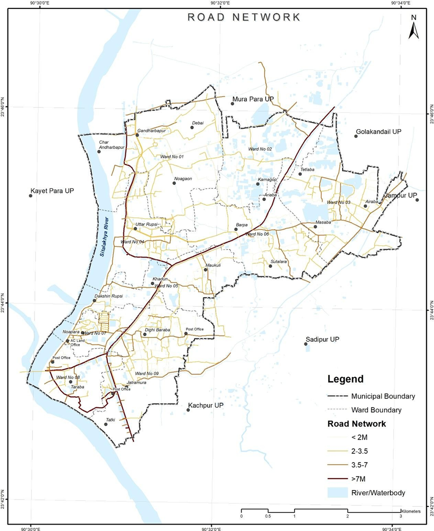
Figure 4 Illustrations of road network extracted from open source, Tarabo (Bangladesh):
Source – CWIS spatial analysis, Innpact Solutions and GWSC
No Comments